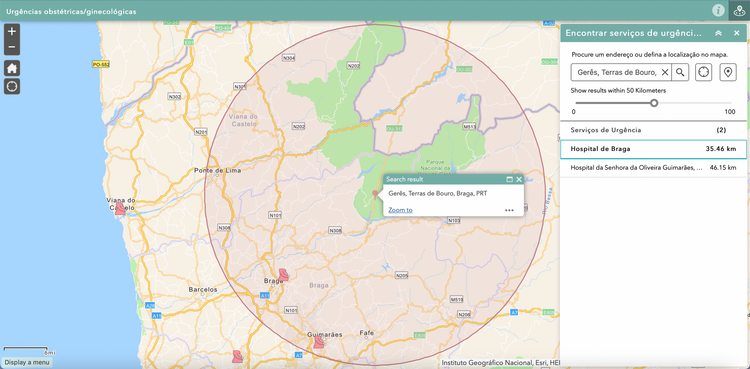
Tutorial – Where are the nearest OBGYN emergency rooms and maternity wards?
If you're in Portugal, you're probably aware of the recent constraints in access to obstetric emergency
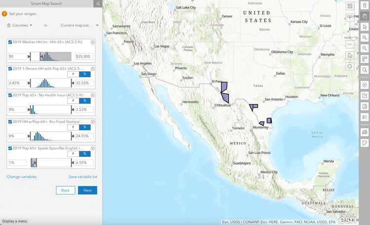
Tutorial – How to find areas that match a set of demographic variables and produce infographics
The increase in longevity is an excellent achievement for humankind, but it also introduces various challenges to our societies. Older
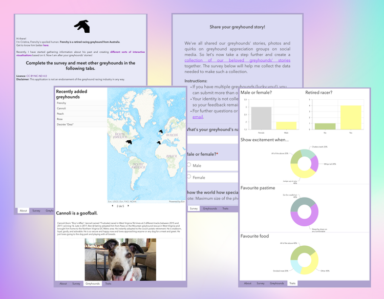
Tutorial – How to create a 3-in-1 app to crowdsource data, perform analytics and share stories
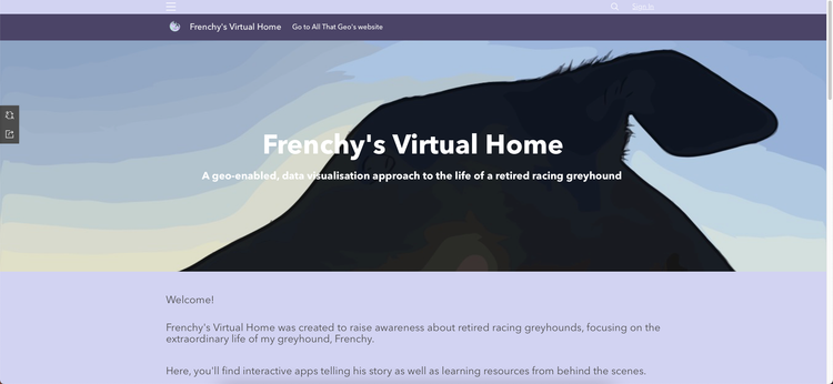
A few months ago, I dedicated myself to a special pet project (pun intended): I wanted to share my dog
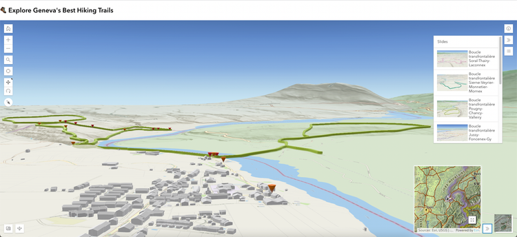
Tutorial – How to build a 3D hiking app
In this tutorial, you'll create an app displaying hiking trails in 3D.
More specifically, you'll:
* Get
Tutorial – How to crowdsource data and use it to create a digital map tour
In this tutorial, you'll create a story map that includes a map tour and a survey to crowdsource
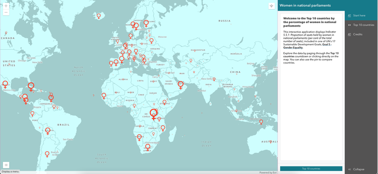
Tutorial – How to create a top 10 countdown in ArcGIS Online
In this tutorial, you'll create an app showcasing one of SDG's goals
[https://www.allthatgeo.com/
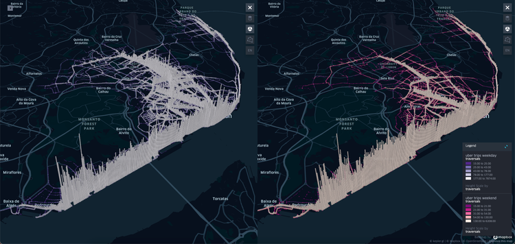
Tutorial – How to create a 4D visualisation of urban mobility data with Kepler.gl
1 Choose the tool
Choose → Prepare → Create → Share
There are two compelling arguments for you to use Kepler.gl [https:
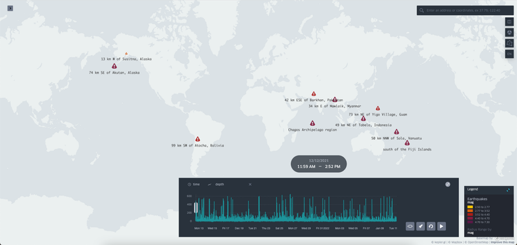
Tutorial – How to create an animated visualisation of earthquakes data with Kepler.gl
1 Choose the tool
Choose → Prepare → Create → Share
There are two compelling arguments for you to use Kepler.gl [https:
Tutorial – How to assemble your web apps and build a hub site in ArcGIS Online
In this tutorial, you'll find the workflow I followed when building Frenchy's
Virtual Home [https://frenchythegreyhound-