
The Monthly with All That Geo – May 2022

Welcome back to The Monthly with All That Geo by me, Cristina. Every issue will bring you a new learning experience on geospatial data visualisation, analysis and storytelling.
💬 In this month's issue:
Also:
- Reminder: your perks as a member of All That Geo
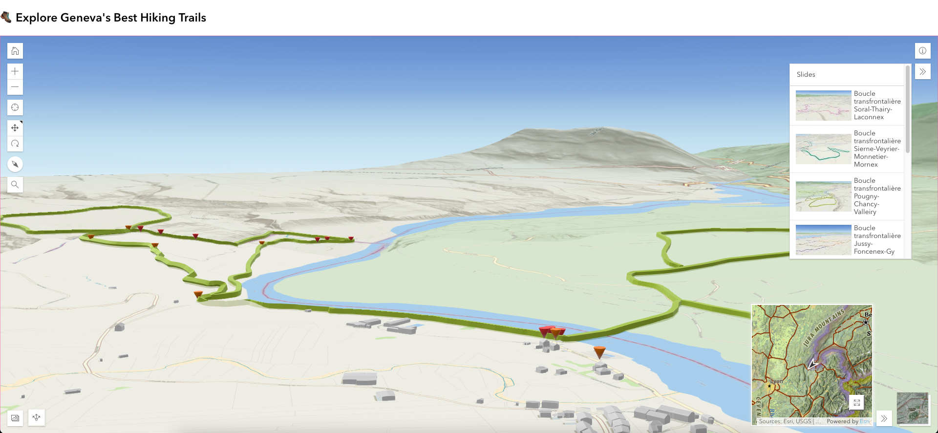
🥾 How to build a 3D hiking app
Now that the weather is getting warmer in the northern hemisphere, I'd like to invite you to hike - virtually! - in Geneva (Switzerland). So, in this month's tutorial, you'll build an app displaying hiking trails in 3D.
More specifically, you'll:
- Get data from the Geneva Territory Information System (SITG).
- Explore metadata and access web services.
- Create a web scene with ArcGIS Scene Viewer (including setting up a local scene, choosing a basemap, adding layers, capturing slides and clipping to an extent).
- Build a 3D Viewer App (including using the web scene you created earlier and configuring the app's details, interactivity, look and feel).
- Publish your 3D hiking app.
- Make a short URL to customise your app even further.
🤔 But Cristina, why would I want to create a hiking app in 3D?
I'm glad you ask! Well, for multiple reasons:
- Promote local trails in your region.
- Showcase trails curated by you.
- Take a virtual hike when you cannot join the hiking party.
- Assess a trail before doing it in real life.
- Share your hiking adventure with your friends.
Happy hiking!
💡 Reminder: your perks as a member of All That Geo
Did you know that, as a member of All That Geo, you have exclusive access to special bonuses?
🎶 Enrol in a free mini-course: You’re sitting on a data goldmine! Visualise what you listen to on Spotify with ArcGIS Insights
🎁 Receive a discount code for the Introduction to Geographic Information Systems for Public Health - an open-source approach course on Udemy. Reply to this email, and I'll get you one!
In addition, there are more open-access learning resources for you:
📖 All That Geo's blog: data visualisation tools explored and reviewed; inspiring organisations and projects enabled by location data; and valuable tips & tricks to make your mapping and data visualisation journey easier.
📝 Step-by-step tutorials on geospatial data visualisation, analysis and storytelling.
😄 Tales of All That Geo webcomic (some would say this is not exactly learning content... decide for yourself!).
📬 The Monthly with All That Geo newsletter archive.
Feel free to explore the website, and do not hesitate to let me know how I can enrich your learning journey in some other way.
💌 Enjoy this newsletter?
You can help it (me!) grow and reach more people, which would be lovely. Forward to a friend and let them know where they can subscribe (hint: it's here).
Anything else? Hit reply to send me feedback or say hello.
See you next month!
Take care and keep learning,


Member discussion