Dec
02

Battle of geospatial tools for beginners: CARTO vs Kepler.gl
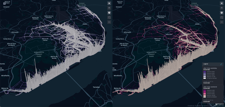
🤔 What is CARTO?
CARTO is an open-source, cloud-based location intelligence platform. More on CARTO here.
🤔 What is Kepler.
3 min read