
Battle of geospatial tools for beginners: CARTO vs Kepler.gl
🤔 What is CARTO?
CARTO is an open-source, cloud-based location intelligence platform. More on CARTO here.
🤔 What is Kepler.gl?
Kepler.gl is an open-source, web-based application to visualise location data. More on Kepler.gl here.
🎆 Examples of visualisations in…
… CARTO:
- Transport
- TRANSPORT NETWORK GEOSPATIAL ANALYTICS
- CARTO Traffico
- Real Estate
- Location Intelligence for Real Estate: Overcoming Unprecedented Shifts with Predictive Analytics
- Healthcare Analytics
… Kepler.gl:
- Daily bus boarding in São Paulo
- Visualising Traffic Safety with Uber Movement Data and Kepler.gl
- Visualising the Spread of COVID-19 in the United States
💿 How to import data to…
… CARTO:
- Shapefile
- Keyhole Markup Language (KML)
- Zip-compressed KML file (KMZ)
- GeoJSON
- Comma Separated Values (CSV)
- Spreadsheet
- GPS Exchange File (GPX)
- Open Street Map File (OSM)
- MapInfo file
- CARTO file
- GeoPackage (GPKG)
- File Geodatabase (FGDB)
… Kepler.gl:
- Comma Separated Values (CSV)
- GeoJSON
- JavaScript Object Notation (JSON)
🧳 How to export data from…
… CARTO:
- Comma Separated Values (CSV)
- Shapefile
- Keyhole Markup Language (KML)
- GeoJSON
- Scalable Vector Graphics (SVG)
- GeoPackage (GPKG)
- CARTO file
… Kepler.gl:
- Comma Separated Values (CSV)
👥 How to share visualisations in…
… CARTO:
- URL
- HTML
- CARTO file
… Kepler.gl:
- Image
- HTML
- JSON
- URL (requires a Dropbox account)
👍 Advantages of…
… CARTO:
- Intuitive and easy to use
- Spatial analysis tools (buffer, intersection etc.)
- Data management options, including geocoding
- Widgets
- Handles real-time data
- Privacy features
… Kepler.gl:
- Easy to use
- High-impact geospatial visualisations
- Effective mapping of large time-enabled data
- Effective mapping of clusters and density
- Ideal for mobility visualisations
👎 Disadvantages of…
… CARTO:
- Nothing major
… Kepler.gl:
- Data needs to be pre-processed
- Lack of analytic tools and insights
💰 Pricing of…
… CARTO:
- Paid plans (free trial: 14 days). Note: the individual plan was not available on the website when this text was written.
- Student account
… Kepler.gl
- Free
👩🏫 Training and other valuable resources to get started with…
… Carto:
… Kepler:
- User guides
- Get started
- 4D Data Visualization with Kepler.gl
- Visualising geographical data with Kepler.gl (Michele Mauri)
- [Visualization Nights] Introduction to Kepler.gl
🤝 Carto + Keppler.gl?
What if you did not need to choose? With the Kepler.gl integration, you can manage your maps in one single place and work on them across both tools: Kepler.gl and CARTO. More information here, here and here.
🏆 Winner of the battle
Kepler.gl is flashy but gets limited fast. CARTO offers more geospatial analysis functionalities and is a proper location intelligence platform.
🎆 Do you want to create your own apps with Kepler.gl? Then, you might find these tutorials helpful:
 Cristina
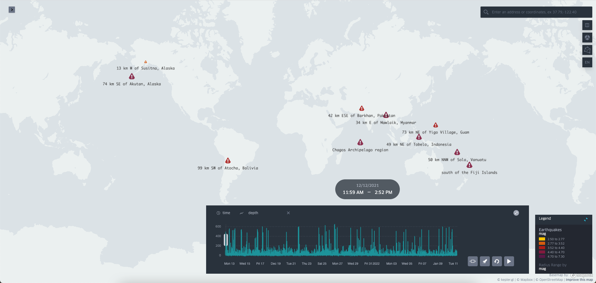 Cristina
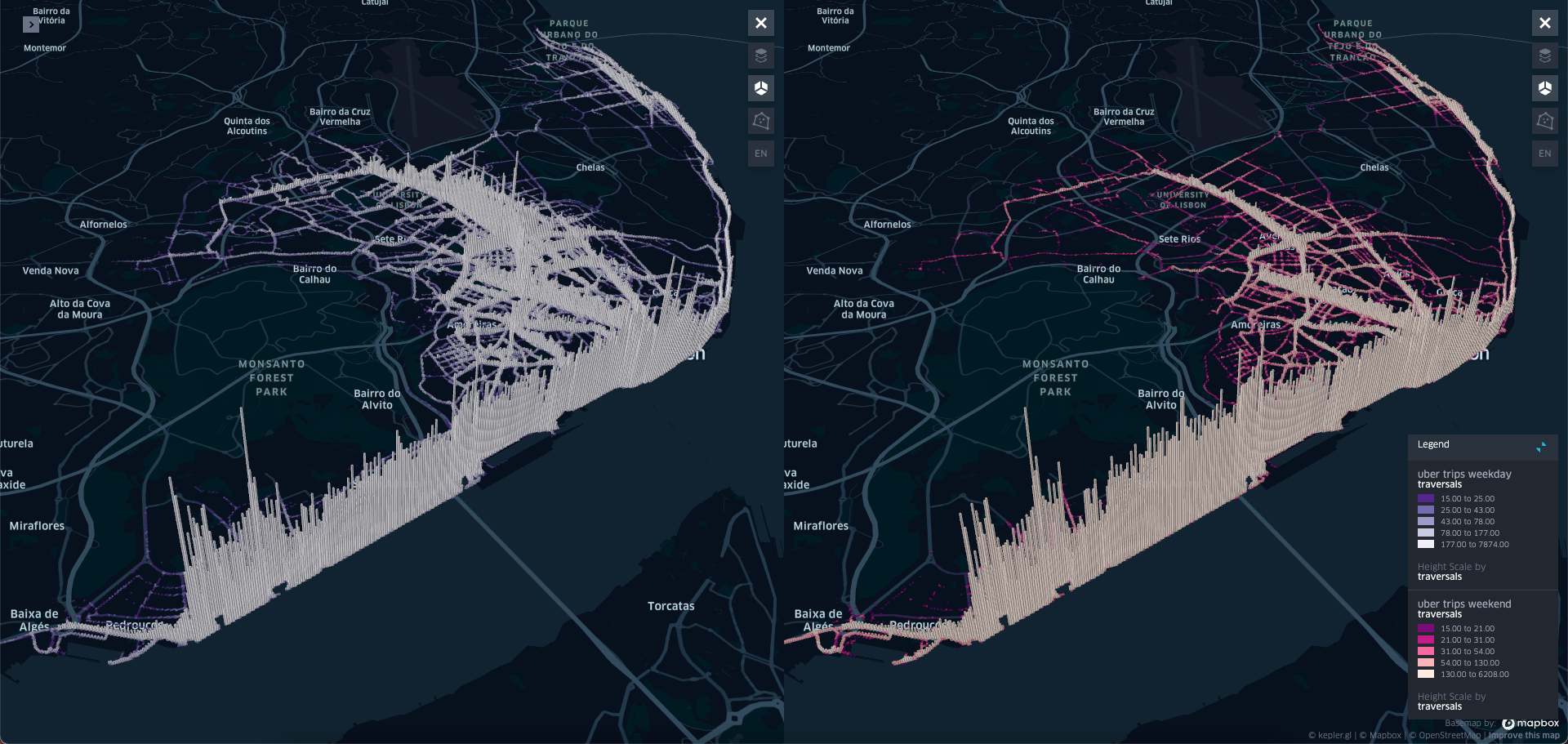
The Monthly with All That Geo
Want to learn how to use ArcGIS Online for spatial, data-driven storytelling? Sign up for The Monthly with All That Geo and I'll deliver a new example of an interactive web app straight to your inbox every month.
You'll get a behind-the-scenes look at how it was built—from the data collection process through the final app—so you can practice your own data visualisation skills and unlock your creativity as you go.
If you want to find inspiration to start a project that will make a difference in your study area or work, sign up for The Monthly with All That Geo!


Member discussion